 |
| I'm coming for you, Sauron |
Well, OK, it doesn't look exactly like that. But you get the idea.
(Warning - this post is replete with Lord Of The Rings references. If you're too cool for such fantasy nerd speech, well, there are other blogs.)
In fact, my plan was to summit Mt. Ngauruhoe, an active volcano which rises from the southern rim of Mt Tongariro's main crater to a height of 2291m (about 7500 feet). It's an almost perfectly symmetrical cone, which is why Peter Jackson used it as the basis for Mount Doom in the Lord Of The Rings movies (but with the addition of a bunch of digital video magic).
Why Ngauruhoe? Well, it looks pretty cool, seemed to be a more interesting climb (steep and loose) than usual... but let's face it, I just wanted to climb Mount Doom.
All our travel guidebooks and the Department Of Conservation visitor kiosks give exceptionally strong warnings about climbing Mt. Ngauruhoe. Like: you have to be in exceptionally good shape, the climb is very steep and is nothing but ash and deep, loose volcanic rock that can fall on you, the weather can go from balmy to blinding blizzard in a heartbeat, etc. etc. After hearing all this, I was a bit worried about my lack of equipment and fitness - but no one said not to go, and the forecast was for a gorgeous, sunny day.
I had terrible hiking footwear - a pair of flexible-soled running shoes masquerading as hiking shoes, with about 20% tread remaining. But rather than risk uncomfortable rental boots, I only rented a pair of trekking poles.
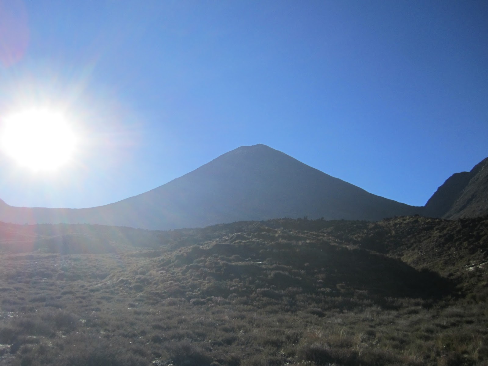
Morning sun beside Mt. Ngauruhoe as I set off.


I hope the ring wraiths haven't seen me yet, but I'm still in the shadows at this point so the odds are low.

After just over an hour, I was at the foot of Mt. Doom. The idea is to stick to the more solid rocky bits slightly left of center - everywhere else is so loose it would be like climbing a giant pile of feathers. Alright, slow and steady.

So here I am, partway up. Yep, that's quite the slope. Those trekking poles I rented were gold. My footwear would have made this climb miserable-to-impossible without poles. And yet none of the many other people doing this same climb were using poles - instead they were using all four limbs, and were clearly working a lot harder than me.

Just after one of the rocky outcrops, looking back down on the main Tongariro crater. The crossing trail goes from left to right across the crater, then up to the rim at the low point on the right side. To get to the peak of Mt. Tongariro, you follow the rim counterclockwise to the highest point on the left of the crater rim.

There's an outer crater near the top of Mt. Ngauruhoe, with a taller, higher crater inside it. This is steam escaping from rocks on the outer crater rim.

The last push to the top was steeper and looser than the rest of the climb, and the rock got redder.

The view from the top. Wow. Note the cloud behind tiny Blue Lake in the center of the photo - it's not a cloud, it's gases escaping from the eruption zone, and the reason that the Alpine Crossing was closed.

Outer crater rim and escaping gases.

The Mt. Tongariro summit trail follows the ridge at the bottom of the photo, and Lake Taupo is in the distance.

The crater of Mt. Ngauruhoe - it's actually quite deep and steep, with a bit of snow at the bottom.

The people on the right give some perspective on the size of the crater.

I walked around the inner crater rim to get the full 360-degree views.

Outer crater rim with some snow hiding in the shadows.

Tell me THAT doesn't look like Mordor - all blasted volcanic rock and noxious gases. Cool.


Pretty cool layers of different coloured rock in the crater.

Mt. Taranaki - also on the Pacific Ring Of Fire - is almost 140 km away, on the southwest coast.

Mt. Ruapehu next door is the tallest mountain on the North Island, and is also home to New Zealand's largest downhill ski area. It presently has the same volcano alert level as the steaming Mt. Tongariro - any hiking within 2 km of the peak is "at your own risk."

The parking lot and trailhead where we started, far below.

The valley walk during the first part of the hike - lots of cool lava rock.

As a tribute to Frodo Baggins, I decided to get a shot of my hairy hobbit feet at the crater of Mt. Doom.


That eruptive zone really sends up some big gas plumes - probably a good thing the Alpine Crossing is closed.

After 45 minutes on top and one last look at the crater, then it was time to think about heading down. Mission accomplished.

But I didn't want to leave this crazy, rocky view.

Alright, soooo... I guess it's just straight down the extremely loose, steep, abrasive rock slope then?

Go hard or go home!

I kept my camera packed away from the pervasive volcanic ash for the downhill trip, but I did take a couple of shots just after I began descending - the first part was the steepest, loosest and most worrisome. Above you see the view uphill to the top.

Here is the corresponding view towards the bottom.

And a view to the right. Yowza.

I made it down in one piece! Sweet! I then took off my shoes and poured at least 150 mL of dirt out of each shoe - low-rise shoes are NOT appropriate footwear for that kind of descent.

That was my descent path - just straight down the face.
I checked my watch and... it was around 11:20 am. That took much less time than I thought. The bus wasn't due until 4:00 pm. I asked myself, What Would Shaun Frost do? Climb the other peak, of course.

So I set off across the main crater floor on the path to Mt. Tongariro's summit.

It felt a bit like being on Mars here - extremely cool.

There's my wife, on the way back from the top of her hike! We said hello and then I took off to make sure I wouldn't be late for the bus home.

Up on the rim of the Tongariro crater, Mt. Doom looks mighty impressive.

Gulp, I guess I, uh, just stumbled down that slope, eh?

Lovely ridge walk to the peak of Mt. Tongariro, with plenty of unique rock formations.


The peak of Mt. Tongariro.

Me and Mt. Doom, as seen from Tongariro's summit.

The town of National Park, as seen from the summit. It's a small town - hard to pick out.

Then I blasted my way back to the bottom, my trekking poles once again proving their worth on the endless loose surfaces. I passed some great-looking lava gardens near the bottom.

See you later, Mount Doom. Consider yourself defeated!


Feeling good back at the trailhead (around 2:30 pm), and even better to be out of my shoes.

After-hike shoe shot. Note the complete lack of heel tread on the left shoe. And note the chewed-up look of the leather of the right shoe - that was entirely from the Ngauruhoe downhill.

A big meal of homemade pasta and beer caps a perfect day.
Frodo or Chad?
Climbing Mt. Doom didn't seem so frightening in the end. I mean, I made it from the (upper) foot to the summit in under an hour and in bad footwear. But Frodo Baggins gets three books written about him for the same thing, and it took him nearly forever. And he didn't even have to go all the way to the top - he went in through a tunnel halfway to the peak. What gives?
Well, I suppose Frodo did do it all in bare feet. And he was burdened by the power of the One Ring. And he was being hunted across a continent by legions of undead and orcs and other terrible creatures.
OK then, we'll call it a draw. :-)
LOL! Nice post, there, Chad Proudfoot ("Proudfeet!"). Man. Those shoes look done in. Gorgeous photos by both of you. when Tara and I were in Lake Taupo in 2004, Mt Ruapehu was given off some pretty serious volcanic activity too; we drove out and took a look, but no hiking for us. Hot springs at Lake Taupo tho? Absolutely :).
ReplyDeleteBtw, speaking of LOTR, the b&b we stayed at in Lake Taupo was owned by the brother of the man who farm was turned into Hobbiton. How bout that, eh!! Like being right beside royalty...:)
Pictures 40 & 41 of Ngauruhoe are awesome. Is the red in the rock from iron? Kind of wish we had done the hike when we were there.
ReplyDelete(Tara)