I shouldn't be so dramatic. We warmed up, our breakfast was fine (better than most hostels we've stayed at in South America), and the hot refugio breakfasts aren't exactly gourmet anyway. You can tell Sarah is glad to be somewhere warm!
And the hut is not exactly roughing it, either. Check out the morning light in the breakfast room.
And the view from the breakfast room is pretty top-notch too. Best of all, it didn't seem particularly rainy. However, if we thought Day 2 was windy, Day 3 had something to teach us.
The Big Kahuna
This was our single biggest day of the trek - from Refugio Los Cuernos, west to French Valley (the middle arm of the W), up to the viewpoint at the top of the valley (about 700m of semi-steep elevation gain) and back, then along to the bottom of the western W lobe and Refugio Grande Paine. If you believe the National Parks Map of the route, that's 28km. I don't believe the map - it's pretty inaccurate in many ways, and I suspect it was more like the low 20s of km at most.
The famous Patagonian wind was in fine form right from the start, gusts hitting the refugio windows like a hammer. The lake was crazy - not just whitecapped, but full of cold-air squall lines shoving massive cobwebs of white condensation (some over 100 feet high) across the lake at high speed, some turning into mini-twisters. Totally amazing to watch, though impossible to capture on camera.
 |
| Squall mist visible across the blustery lake |
(Science nerd note: I haven't verified this, but it looked like gusts/masses of cold air - cooled by the glaciers above and behind us - would drop onto the lake, shoving themselves underneath the lighter, warmer air above the lake. Where the leading edge of the cold gust touched the warm, moist lake air, it would cool it to a point where it could no longer absorb so much moisture - and the water vapour in the cooled lake air would condense, forming thin, cobweb-like clouds at the interface between two air masses. These cobwebs allowed one to see the invisible "avalanche" of cold air as it pushed over the lake. Also, while some of these gusts started from the shore of the lake and ran across it (cold air rushing down the slope to the lake), some of them started from a point in the middle of the lake and spread outward in concentric circles (cold air dropping from directly above the lake; maybe "jumping" from the high glaciers to the middle of the lake, propelled by the high winds). At any rate, it was really, really cool.)
 |
| Brace yourself for this gust! |
We started our day with a stroll along the beach. A lovely salt-and-pepper, black-and-white stone beach.
Perhaps a bit chilly/windy for a dip, though!
Sarah was in her groove once again, ready for this next challenge. Though she also passed on the swim.
There's a smaller, higher valley between the eastern and middle arms of the W that you are only allowed to access with a guide. Next time for sure...
We skirted the shoulder of the massif for a couple of hours, getting used to bracing against wind gusts and predicting them with sight (lake mist) and sound (blowing through nearby trees). While it wasn't really raining, the wind was strong and cool enough that even I was wearing pants. (They dried/cooled almost instantly in the winds, so overheating and getting damp were not issues.)
We reached Campamento Italiano campground at the bottom of the French Valley, and thankfully dropped our big packs at the ranger shack so we could do a lighter/faster climb up the valley. The wind was careening down the valley pretty strongly, carrying some specks of snow from the peaks above, and hurrying clouds and weather through. I love wind, so the prospect of a good blow while armed with my gore-tex was exciting. Sarah, being lighter and daintier than I, was slightly less keen, though still game.
The climb starts up the side of a large rockfall/boulder field. After some minutes, Sarah decided that the many kilometres of hiking and wind were taking their toll, and it might be better if she sat out the full valley hike to ensure she could make it the remaining 8 km to the refugio that evening. So she returned to the ranger hut and looked as wind-blown and shivery as possible - which worked perfectly since the two friendly rangers (brothers) invited her into their wood-stove-heated cabin, offered her yerba mate and gave her an opportunity to practice her Spanish for a couple of hours. [Sarah's note: This actually ended up being one of the highlights of the W trek for me - I learned that I spoke enough Spanish to get by for a couple hours with two non-English speakers and got to talk to the rangers about the abnormally high winds, Latin American hip hop, and what it's like to live at Italiano most of the time.]
Meanwhile, I got cracking up the slope, the trekking poles adding an unexpected boost in uphill speed. Views were questionable, as the winds kept blowing clouds down the valley and the surrounding peaks were only intermittently and dimly visible. But it was wintry Patagonia and looked like it should!
After a bit less than an hour, you get to the top of the rock slope (right side of the above photo) which is the viewpoint where many people turn around. Often this is because they are saving their energy for the rest of their hiking day by avoiding the additional 1-2 hours to the top and back. But today, it was probably because that exposed shoulder, right in the path of a pass above it, was the windiest place of the entire hike, and a lot of hikers were getting rejected by the wind. Not kidding! I was laughing semi-maniacally as I crossed the rocky crown that had been blown free of everything except low scrub - you had to really plant yourself and walk strongly to remain upright - in a strong gust, it was best to get low and wait for it to back off slightly. You could lean a good 20 degrees to the side without falling as you traversed the moving air. I'd say average wind speed there was about 70-80 km/h, with gusts definitely exceeding 100 km/h. (I've experienced 130 km/h gusts in the past, so I don't think I'm exaggerating.)
The rangers said this was an uncommonly windy day for this time of year in this area.
Rather than planting and pushing into the wind (or dropping low or sitting down), each gust forced many hikers to take several steps with the wind before regaining their balance and slowing to a stop - very dangerous when on an uneven surface with drop-offs to one side. While Sarah was at the ranger hut, a (fit, healthy) Italian guy stumbled in who had been blown off the viewpoint, fallen some distance and dislocated his shoulder. But this isn't Canada or the USA - you don't have search and rescue teams waiting at the bottom of the hill, and an airlift won't happen unless you're minutes from death. He could still walk, so there would be no extraordinary assistance. There was a nurse in camp who fashioned a sling around the guy's arm and gave him a bunch of painkillers - then it was up to him and his friends to hike 8 km (in flat terrain but high winds) to Grande Paine, where they could catch the last ferry of the day across the lake, followed by a 2+ hour/120 km bumpy bus ride back to Puerto Natales, the nearest place for serious medical attention. Lesson: don't get injured on the W route!
Rimed glaciers lining the route up the valley.
Sun unsuccessfully tries to break through the rushing clouds around Cerro Cuernos and other peaks.
The wind backed off slightly after the viewpoint, and the path leveled out and followed a river up and over a pass and into the bowl at the top of the valley.
Higher up, there was about 2 cm of snow left over from the previous day's precipitation, but it wasn't cold and it somehow made the forest seem friendlier. The parks office had declared the final part of the trail (from the last campsite to the upper viewpoint) closed due to snow, but there was never more than a skiff and the trail was perfectly safe all the way up.
It wasn't really snowing, but the wind blew snow off of surrounding peaks and into the valley.
After a bit more hiking I hit the upper campsite - Camp Britanico. It was understandably still closed for the season - I wouldn't want to haul a big pack up those slopes in those winds, and the inclement weather would make for an uncomfortable and potentially loud night.
 |
| Rough shelter at the upper campsite |
Just a quick 15 minute walk further and a scramble up some rocks to reach the end of the trail at the upper viewpoint.
Yeah, big wind and snowy peaks, that's what we came for!
Unfortunately, despite waiting 10 minutes for the weather to clear, this was all I could see of the peaks at the end of the valley. That's Patagonia.
But looking down the valley there were some nice views.
And on the way back down it cleared up a little bit for several minutes, for a better view of the peaks behind Cerro Cuernos.
And I even got a glimpse of the peaks at the end of the valley that I missed before.
No, that's not a Hollywood backdrop painting, that's really me and the mountains.
This big broken branch was not in the middle of the trail on the way up... Apparently my concern about "widowmakers" while walking through the forest in high winds was not entirely paranoia.
Here's the view looking down from the high-wind viewpoint that caused so many hikers problems. Seems innocent enough, right?
And here's a short video of the high wind area. Note that this is a moment of somewhat low wind speed for that area, and it's not shot in fast motion - that's really how fast the shrubs vibrate in a strong wind.
I picked up Sarah from the ranger hut and we began the most flat hike to Grade Paine refugio.
Starting off was a very loose suspension bridge crossing in a high wind. Not the most secure feeling I've experienced.
Sarah was recharged and ready for action. No rain = happy times.
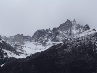
We still had some nice mountain views.
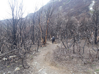
As well as some more sobering views. We entered the remnants of a massive forest fire that burned a big section of the park in December of last year. It was allegedly started by an Israeli tourist who tried burning his toilet paper (forbidden in the first place) and lost control of it. You can imagine how these high winds could spread a fire. In fact, Chile just expelled a couple of more Israelis for camping outside of a designated campsite (also forbidden - and most campsites are free anyway). It's understandable that they're sensitive about breaking park rules these days, especially if you're Israeli.
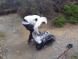
The wind picked up and some gusts occasionally approached French Valley strength. Sarah had a rough time keeping her balance, as her rain cover was too big and her pack too empty, so it acted like a spinnaker and caught the full power of each gust that came in. She put away the cover and fared much better.
The further we got from French Valley, the more things cleared up. The high-altitude wind clouds were incredible - like unearthly, stacked mushrooms.
Finally we approached Lago Pehoe, the sky-blue lake that our refugio sits on the shores of.
The whitecaps and wind mists on the lake still hadn't let up.
What? THAT'S a refugio? Grande Paine looks more like a resort hotel. Probably because it's also the destination for the 30 minute catamaran ride that takes tourists on day trips to this end of the W route. We would return to Grande Paine to take the catamaran back to civilization in 1.5 days. After today's big hike, such comfort was very welcome. [Sarah's note: Although, in the end, this was actually our least favourite refugio. While it was big and fancy, it was also full of people coming and going and felt quite impersonal.]
View #1 from the refugio.
View #2 from the refugio - it cleared up quite a bit after we left French Valley.
View #3, from the upstairs refugio bar.
What's that, you say, a refugio bar? Yes indeed! And we arrived right at the start of 2-for-1 pisco sour happy hour. The perfect reward for a long, windy day of hiking!
Ahh, that's more like it. Warmed with 2 strong sours apiece, we were joined by Oliver and Roz (from England) in celebrating the completion of the biggest day of the trek.


No comments:
Post a Comment